- Dehradun, Uttarakhand, India, 248001
- info@esoftlogics.com
GIS/GNSS
Web/Mobile Based GIS & GNSS Applications
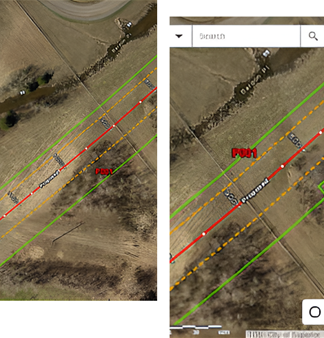
A full suite of mapping tools are available to users of the mobile application, so they may explore their surroundings. The program improves the user experience for Android devices with satellite imagery, vector data, image, cloud server sysc.
The user-friendly interface of the app makes it simple for users to find locations and . The satellite imagery gives users a visual depiction of their surroundings. User can add external precise GNSS receives for accurate survey.
GIS/GNSS
Web Based Map Publishing & Integration
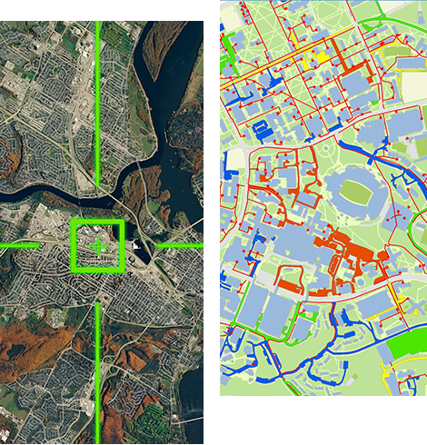
The platform’s intuitive interface, efficiency in map creation, flexibility in data handling, customization options, & seamless integration with other GIS Cloud applications make it an essential tool in the GIS toolkit. Designed for both GIS experts & beginners, Map Portal’s intuitive interface ensures ease of use, making complex GIS tasks accessible to all.
With its ability to quickly produce detailed and information-rich maps, Map Portal is ideal for users working under resource constraints. Supporting a wide range of data formats, including vector and raster tiles, Map Portal is adaptable to various GIS applications.


GIS/GNSS
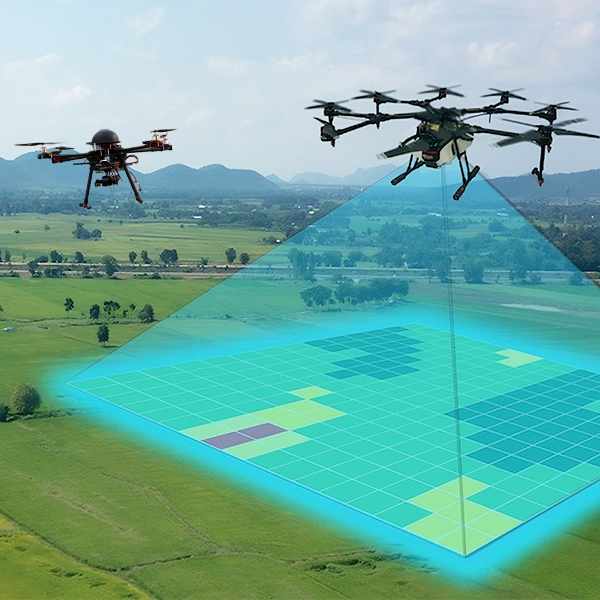
Drone Surveying & Mapping
Efficiently capturing raster data and video to generate detailed maps, our Drone Surveying & Mapping services extend to the comparison and analysis of images and videos for a myriad of specialized tasks. We specialize in utilizing drone technology to provide a range of services tailored to specific needs.
Whether it's mapping landscapes, conducting detailed image and video analyses, or fulfilling other drone-based requirements, our capabilities are diverse and adaptable. With a focus on precision and versatility, our solutions cater to a wide spectrum of applications, ensuring effective and reliable results for various industries and tasks.